Geovane Metmast

Description

A patented invention that finally solves the inherent uncertainties in wind direction measurements. By adding a Geovane to your wind measurement campaign configuration you will get the most accurate wind direction data available on the market today. Guaranteed!

Case Study 10

South Korea

Case Study 7

Egypt

HOW CAN WE HELP?

Tell us what you need by filling in the form below and we will get back to you.


A patented invention that finally solves the inherent uncertainties in wind direction measurements. Given the impact incorrect wind direction measurements have, the updated IEC-61400.12.1 (2017) now requires complete assessment of wind direction measurement uncertainties. The Geovane enables you to do exactly that!

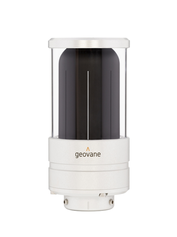
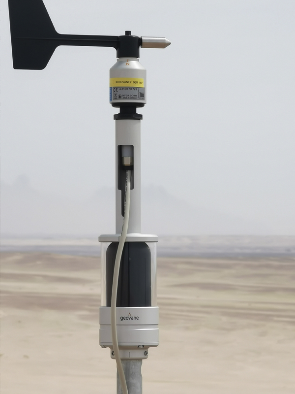
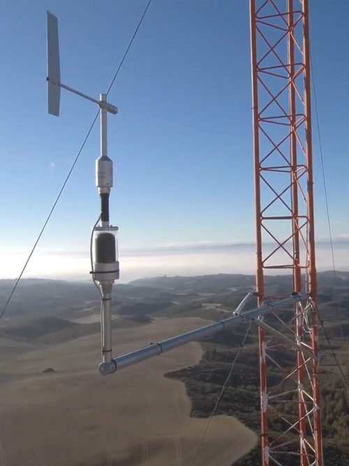
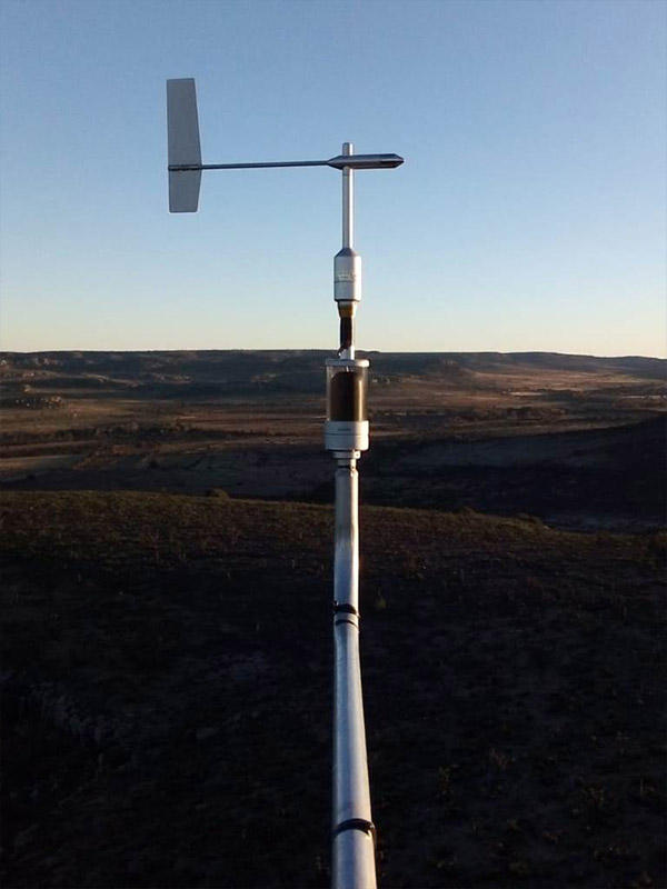
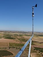
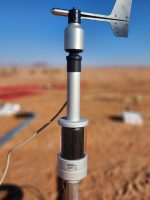
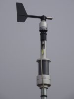
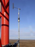
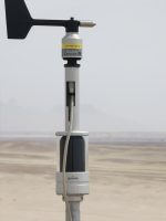
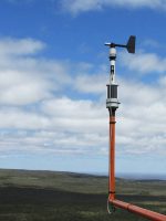
Being equipped with high-resolution optoelectronic sensors, composed of 2048 photo sensing pixels, the Geovane uses the Sun to measure the True North offset of sensor coupled to it, resulting in more accurate direction measurements than ever possible before.

The True North wind vane offset is obtained by comparing the theoretical solar azimuth angle calculated by the Geovane’s embedded processing unit with the observed azimuth value read by its built-in photo sensing pixels. The Geovane offers three type of outputs: frequency, analog voltage and digital over a RS-485 serial interface. By adding a Geovane to your wind measurement campaign configuration you will get the most accurate wind direction data available on the market today. Guaranteed!

M.O.E as an accredited IEC/ISO 17025 test lab was requested by Kintech Engineering to carry out a thorough validation with respect to the Geovane accuracy. The tests prove that the Geovane allows to consistently determine the true orientation of a wind vane with an uncertainty less than 1º.

Click here to see our patent titled “Device for Determining the Orientation Error of a Wind Sensor”

Click here to download the test summary by M.O.E

Click here to download the Wind Europe 2017 publication titled “Novel Approach To Wind Direction Measurements”.

Click here to read an article about the Geovane called “Geovane: True North, The Right Way!”

Click here to read a case study where the Geovane was used and detected a misalignment of the wind vanes with respect to True North of 14 degrees.

We have prepared a website just for the Geovane. For more details go to www.geovane360.com
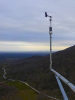
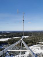
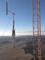
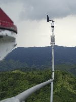
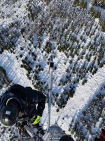
Early Adopters

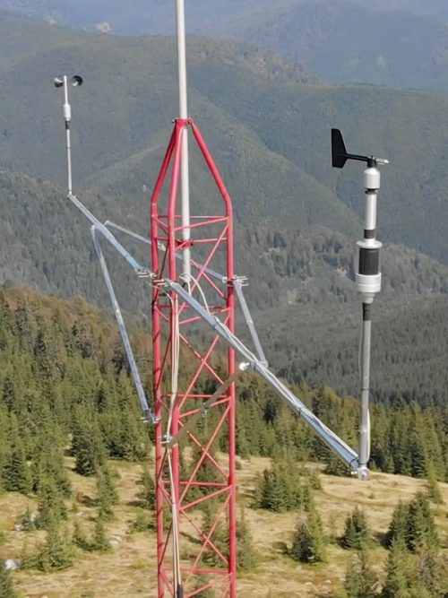
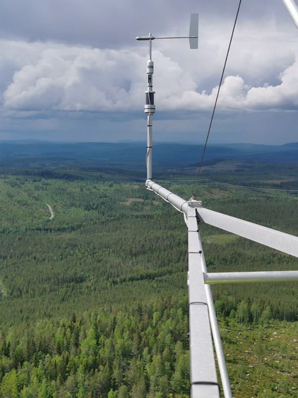
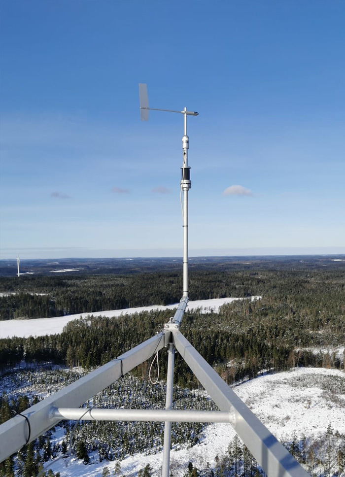
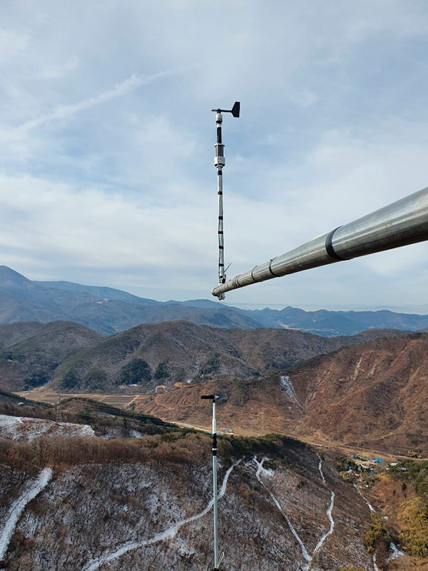
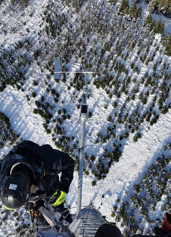
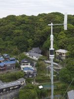
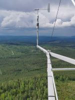
Here are some of the early adopters and users of the Geovane Metmast. The Geovane Metmast presented a unique opportunity for them to lower the uncertainty in their wind direction measurements in a significant and consistent way.

They are all leading wind power developers and suppliers of renewable energy, at the forefront of renewable energy development, and drivers of technological progress in our sector.


In the abscense of sunlight, the Geovane will keep the latest valid data obtained since it was powered on. As soon as it receives sufficient radiation from the Sun, Geovane will update its orientation output. This temporary “pause” does not imply any inconvenience due to the nature of the data.

Assuming that the Geovane has been properly aligned with the wind vane by means of its built-in laser, the Geovane will then continuously provide the angular wind vane offset with respect to Geographic North. The user should then apply this offset in the post processing of the dataset.

Yes, the Geovane is fully compatible with any industry standard data logger through the following output options:

  • Frequency ouput 30-130Hz (0-5V square wave)
  • Analog output 0.5-4.5V
  • RS-485 digital ouput

At the moment, the wind vanes that are hardware compatible with the Geovane are: Thies First Class, Thies Compact, Young Wind Monitor, Young Wind Monitor Alpine, Vector W200P. In the future, it will be possible to extend compatibilty even further.

No, the Geovane is not wired in any way to the wind vane. The Geovane and the wind vane are two separate sensors, each with its individual data cable connected directly to the data acquisition system.

The Geovane_turbine application offers the exact orientation of the turbine’s nacelle with respect to True North. Aligning all your wind turbines to the same angular reference point enables the wind farm operator to compare yaw turbine alignments.
This means that all the turbine yaw encoders in any given windfarm now have the same reference point.
The Geovane_turbine application is specifically developed for turbine alignment and includes ad hoc hardware and software.

By adding a new wind vane equipped with a Geovane to an already existing met mast, you are able to correct existing wind direction datasets without altering the consistency of previous wind vane measurements.

If the Geovane is installed from the beginning, it is possible to have wind direction datasets immune to the torsion of the tower structure or bended sensor booms. Throughout the measurement campaign, the Geovane will provide the updated offset, achieving absolute accuracy and greater guarantees to external auditors and financial investors.

No. Any orientation can be used, since the azimuthal Field of View (FOV) of the Geovane is 360°. The Geovane should obviously be perfectly aligned with the e.g. wind vane (see the user manual how to do this).
It is recommended that the wind vane’s cable is positioned in such a way, that it runs down the side of the Geovane facing the nearest Earth’s pole or the met mast itself. This is to reduce the shadow projection caused by the cable, but this is not critical.

In addition to the advantages associated with digital communication and EMI immunity, RS-485 digital output allows the Geovane to provide other useful data apart from the orientation offset: tilt of the sensor, boom vibration, GPS coordinates, UTC time…
A Geovane connected via RS-485 can be used as the GPS module for data loggers and RSD without GPS by default.

CHARACTERISTIC DESCRIPTION
Operating voltage6… 30V
Measurement rate1s, 10s, 30s, 60s
Consumption5mA at 12V and 10s (1.5mA at night)
Measurement range0… 360°
ReferenceGeographic North (True North)
Field of View (FOV)360° (azimuth)
Accuracy (3σ)<1.0°
Resolution<0.06°
Digital outputRS-485 (4800, 9600, 19200, 38400, 8N1)
Frequency output10… 130Hz, push-pull 0-5V square wave with 220Ω series resistance
Analog output12-bit resolution 0.5… 4.5V
Temperature range-25… 85°C
Weight0.815Kg (with wind vane adaptor)
Dimensions163 x Ø80mm (without adaptor)
MountingOnto mast tube Ø34mm

Request a callback

Fill in the form and we will call you back as soon as possible.

Enter your keyword